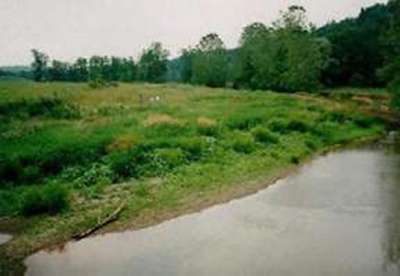
Site 35 - Davis
Davis |
|
Site
Identification
|
| CWC Reference Number: | 35 |
| State: | PA |
| County: | Huntingdon |
| Municipality: | West |
| USGS Quad: | Alexandria |
| Watershed: | Shaver's Creek |
| Hydrogeomorphic Class: | Mainstem Floodplain |
| Disturbance Class: | Severe |
| Dominant Vegetation Class: | PEM |
| Wetland Area: | 0.4 ha (0.9 ac) |
| Year(s) Sampled: | 1994 |
Site 35 - Davis
|
Vegetation
|
| Herbaceous |
| Percent cover: | 95.9% (range 70-100%) |
| Dominant Species |
| Common Name: | Scientific Name: |
| Goldenrod | Solidago sp. |
| Fescue | Festuca sp. |
| Creeping thistle | Cirsium arvense |
| Rough cockle bur | Xanthium strumarium |
| Woody |
| Percent cover: | 0.0% |
| Dominant Species |
| Common Name: | Scientific Name: |
| Willow | Salix sp. |
| Weighted Indicator Status (dominant spp.) |
| Herbaceous: | 3.31 |
| Woody: | 1.67 |
| Indicator Status (all spp.) |
| Herbaceous: | 3.20 |
| Woody: | 1.67 |
| Species Richness |
| Total: | 52 |
| Herbaceous: | 51 |
| Woody: | 1 |
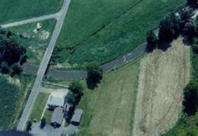
Aerial View of Davis
|
Soils
|
| Matrix Chroma (mean): | 3.0 |
| Organic Matter (mean %): | 3.90 |
| Bulk Density (g/cm2): | 0.76 |
| Soil Series: | Monongahela silt loam |
| Texture (mean %) |
|
Sand:
|
59.4 |
|
Silt:
|
21.0 |
|
Clay:
|
19.6 |
| Sedimentation Rate |
| Mineral loading (g/cm2): | NA |
| Equivalent depth (cm): | NA |
| Organic loading (g/cm2): | NA |
|
Hydrology
|
| Water Level |
| Median (cm): | -54.0 |
| Range (cm): | -55.0 - (-33.0) |
| Water Quality |
| pH (mean): | 7.0 |
| Conductivity (mean): | 1064.0 |