project categories

research project details
| Project Title: | Development and Application of Assessment Protocols for Determining the Ecological Condition of Wetlands in the Juniata River Watershed |
| Investigator(s): | R. P. Brooks and D. H. Wardrop |
| Sponsor: | U.S. Environmental Protection Agency - EMAP |
Project Background:
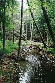 The Juniata Wetland Monitoring Project is 2-year pilot study to assess the ecological condition of
wetlands in the Juniata River watershed of central Pennsylvania. The Juniata River is a major tributary
of the Susquehanna River and lies within the headwaters region of the Chesapeake Bay ecosystem. The
objective of the Juniata Wetland Monitoring Project is to define the ecological health of wetland resources,
thereby providing a scientific context for resource managers to plan future protection and restoration
activities.
The Juniata Wetland Monitoring Project is 2-year pilot study to assess the ecological condition of
wetlands in the Juniata River watershed of central Pennsylvania. The Juniata River is a major tributary
of the Susquehanna River and lies within the headwaters region of the Chesapeake Bay ecosystem. The
objective of the Juniata Wetland Monitoring Project is to define the ecological health of wetland resources,
thereby providing a scientific context for resource managers to plan future protection and restoration
activities.
The study is a cooperative effort between the Southern Alleghenies Conservancy and the Penn State Cooperative Wetlands Center (CWC). A similar project is also underway for the Nanticoke River watershed in Maryland and Delaware co-directed by The Nature Conservancy and the Smithsonian Environmental Research Center. Both pilot projects are being carried out under the direction of EPA's Environmental Monitoring and Assessment Program (EMAP) and are part of a larger program to document the status and trends of the country's ecological resources.
In 1999, the Buffalo Creek/Tuscarora sub-watershed in the Juniata River basin was studied to field verify and calibrate the research protocol. Field testing was carried out at 14 sites by interns from Penn State University, the University of Pittsburgh at Johnstown, and the Pennsylvania College of Technology. For the 2000 field season, approximately 100 randomly-selected wetland sites within the Little Juniata sub-watershed will be studied.
Field Methods:
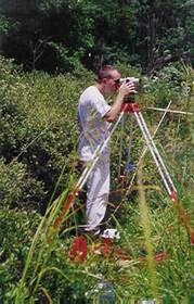
The Rapid Assessment Protocol (RAP) developed by Riparia will be used to assess wetland condition within the Juniata Watershed. The RAP collects information on microtopography, soils, vegetation, wildlife habitat suitability, and wetland stressors. Following data collection, wetland condition will be determined using HGM functional assessment models and will be expressed in terms of HGM type.
Training:
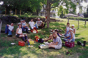
 Prior to the start of the 1999 field season, the interns were given intensive training on surveying
techniques, soil sampling, and wetland plant identification. Strong emphasis was placed on plant identification
because this aspect of the protocol is clearly the most difficult and time consuming.
Prior to the start of the 1999 field season, the interns were given intensive training on surveying
techniques, soil sampling, and wetland plant identification. Strong emphasis was placed on plant identification
because this aspect of the protocol is clearly the most difficult and time consuming.
Plant identification training was structured so that morning lectures were followed by either classroom or field exercises. Lectures focused on the morphological features of ferns and flowering plants (including grasses, sedges, and rushes) and the diagnostic characteristics of the major plant families. For the classroom exercises, herbarium specimens or freshly-collected plants were used to illustrate morphological terms and to allow the interns to practice using both simple and complex keys. Lectures were supplemented with slides, overheads, and handouts. Plant identification manuals used during the class and subsequent field work include Newcomb's Wildflower Guide (Newcomb, 1989), Grasses (Brown, 1992) and Trees and Shrubs (Petrides, 1973).
In addition to classroom instruction, four afternoon field training sessions and one field testing session were conducted. For the field training sessions, four different wetland sites were visited throughout the week including a bog and both pristine and highly disturbed emergent marshes. At each site, interns were divided into groups and given between 10-20 species to key. At the conclusion of each field session, plants were identified and the main features of the plant and its corresponding family emphasized.
 A field test for all skills was held at Millbrook Marsh approximately midway through the field season
to calibrate the interns. Stations were established to test the interns' skills in plant identification,
soils, and topographic surveying. At the plant station, interns were asked to identify plants and estimate
percent cover within a 1m2 plot and shrub volume within a 3-m radius plot.
A field test for all skills was held at Millbrook Marsh approximately midway through the field season
to calibrate the interns. Stations were established to test the interns' skills in plant identification,
soils, and topographic surveying. At the plant station, interns were asked to identify plants and estimate
percent cover within a 1m2 plot and shrub volume within a 3-m radius plot.
The soils station tested the interns on their ability to identify different soil layers, colors, and textures, as well as the presence of redoximorphic features. At the survey station, interns calibrated their paces and were tested on how to correctly sight and operate the level and stadia rod. Of the 14 sites visited during the 1999 field season, the interns were able to identify 162 species of herbaceous plants, 39 trees, and 17 shrubs.
Of the herbaceous plants identified, 13 were grasses, 10 were species of Carex, 5 were species of Scirpus, and 2 were species of Juncus. Grasses, as well as these three genera are generally considered to be the most problematic species to identify.
Condition Assessment:
Wetland Condition assessment is essentially a three-step process. The first step is to develop and calibrate HGM functional assessment models that are sensitive to environmental disturbance. The second step is to randomly sample wetlands within the watershed that represent a range of HGM classes and disturbance levels. The final step is to apply the HGM models to the data collected in the field to determine the condition or health of wetlands within the Juniata River watershed.
Preliminary HGM functional assessment models have been developed by Riparia. These models are currently being calibrated using a set of 102 reference wetlands that span a variety of HGM subclasses (mainstem floodplain, headwater floodplain, riparian depression, slope, etc.) and disturbance levels (severe, moderate, or pristine). Disturbance levels are assigned based on the surrounding landscape, the type of buffer present, and potential stressors identified at the site. It is essential to characterize wetlands across a disturbance gradient to determine not only the level of function a given wetland type may achieve, but also the level of functioning that is attainable in an impacted landscape.
 The second step of the process, data collection, is being undertaken by Riparia and trained interns
from Penn State University, the University of Pittsburgh at Johnstown, and the Department of Environmental
Protection. Two types of data are collected for each wetland sampled: landscape-level data and site-level
data. Landscape-level data is obtained at Riparia by characterizing land uses within a 1 km radius
circle surrounding the wetland using aerial photographs. This gives an indication of the type and magnitude
of potential wetland stressors. For example, activities such as land clearing in the surrounding watershed
may stress wetland systems by increasing sediment loads.
The second step of the process, data collection, is being undertaken by Riparia and trained interns
from Penn State University, the University of Pittsburgh at Johnstown, and the Department of Environmental
Protection. Two types of data are collected for each wetland sampled: landscape-level data and site-level
data. Landscape-level data is obtained at Riparia by characterizing land uses within a 1 km radius
circle surrounding the wetland using aerial photographs. This gives an indication of the type and magnitude
of potential wetland stressors. For example, activities such as land clearing in the surrounding watershed
may stress wetland systems by increasing sediment loads.
In addition to land uses, the buffer type and width is also determined for each site. It is important to look at buffers when studying disturbance because buffers can ameliorate or magnify the affects of negative landscape activities. A wetland surrounded by a forested buffer may not be as stressed by activities in the landscape as one surrounded by an urban or agricultural buffer.
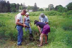
Site-specific data is collected at each wetland site in the field. Site level responses of wetlands to stressors are many and may involve both abiotic and biotic indicators. At each wetland sampled, data is gathered on microtopography, soils, plants, and animals.
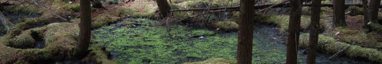
Microtopography:
Microtopographic complexity of the wetland surface may be a good indicator of the health of the wetland system because wetlands subjected to increased sedimentation may show less surface complexity then wetlands not subjected to this stressor. Activities in the surrounding watershed such as road construction and farming may increase sediment loads to wetland systems. When a wetland's capacity for storing sediment has been exceeded, it may begin to fill in. As a result, wetland functions including removal of inorganic particulates, and the dissipation and storage of potentially damaging floodwaters are impaired. Using the RAP method, microtopography is measured every meter along a 100 meter transect.
Soils:
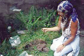 Soil attributes that may be indicative of wetland condition include color, texture, and organic matter
content. Soil colors are generally used as an indicator of wetland hydrology. In wetlands where site
hydrology has been altered, wetland soils may not exhibit colors typical of wetland conditions. Other
soil measures such as texture provide an indication of the wetland's ability to hold water and nutrients.
Soil attributes that may be indicative of wetland condition include color, texture, and organic matter
content. Soil colors are generally used as an indicator of wetland hydrology. In wetlands where site
hydrology has been altered, wetland soils may not exhibit colors typical of wetland conditions. Other
soil measures such as texture provide an indication of the wetland's ability to hold water and nutrients.
The amount of organic matter present in wetland soils is also important because organic matter helps retain soil moisture, reduces runoff, and improves soil fertility. In addition, organic matter provides habitat for soil microorganisms. As part of the protocol, detailed soil profiles are made for each wetland site. Soil data collected includes soil color, texture, moisture, and the presence of redoximorphic features. Soil samples are also collected at depths of 5 and 20 cm and analyzed at Riparia to determine organic matter content.
Vegetation:
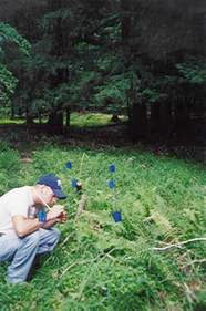 Although not all plant species are highly sensitive to disturbance, the immobility of the plant community,
its amenity to remote sensing techniques, and easily recognized signs of stress make it a good indicator
of wetland condition. Previous studies by Riparia have investigated the potential utility of plant
community measures as indicators of wetland health. Plant community measures that may prove to be good
indicators of disturbance include the FQAI score, the number or dominance of introduced or aggressive
native species, and the number of different species of Carex present. The RAP contains a comprehensive
plant sampling methodology which has been used in a variety of project types. Three sizes of plots
are used to record various measures of the plant community including percent cover and richness of
herbaceous species, shrub volume, and tree dbh.
Although not all plant species are highly sensitive to disturbance, the immobility of the plant community,
its amenity to remote sensing techniques, and easily recognized signs of stress make it a good indicator
of wetland condition. Previous studies by Riparia have investigated the potential utility of plant
community measures as indicators of wetland health. Plant community measures that may prove to be good
indicators of disturbance include the FQAI score, the number or dominance of introduced or aggressive
native species, and the number of different species of Carex present. The RAP contains a comprehensive
plant sampling methodology which has been used in a variety of project types. Three sizes of plots
are used to record various measures of the plant community including percent cover and richness of
herbaceous species, shrub volume, and tree dbh.
Additional Site Measurements:
In addition to microtopography, soil, and plant measurements, site photographs, wildlife observations, and Habitat Suitability Indices (HSI) models are completed for each wetland. The HSI models give an indication of how suitable the wetland habitat is for the following species: bullfrog, muskrat, meadow vole, red-winged black bird, common yellowthroat, American woodcock, green-backed heron, wood duck, wood frog, and southern red-backed vole.