
Published Article/Report
- Miller, S. J., D. H. Wardrop, and M. M. Harlan. 2009. Riparian plant communities as predictors of in-stream condition: a case study in the Upper Penns Creek watershed, Pennsylvania. Bartonia 64: 19-35.
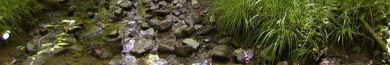
Although riparian and stream habitats are closely linked systems, the ability of the riparian plant community to serve as a consistent and strong predictor of the health of the adjacent instream community has not been empirically explored. We evaluated the efficacy of the Floristic Quality Assessment Index (FQAI) to predict the condition of both mainstem and headwater aquatic sites along Penns Creek, a high gradient coldwater stream in the Ridge and Valley Physiographic Province of central Pennsylvania. We also used Classification and Regression Tree (CART) analysis to evaluate the use of the FQAI in combination with additional landscape and local metrics to determine broad categories of condition for aquatic habitat. Riparian and instream data were collected at 17 sites throughout the upper Penns Creek watershed. Sites were selected to incorporate a range of land uses from forested to agricultural lands and urban/suburban cover, as well as a range of potential chemical properties. Riparian condition followed a pattern predictable for sites in the Ridge and Valley with high quality sites occurring in forested watersheds and low quality sites within agricultural and urban settings. This pattern was mirrored by aquatic insect metrics for headwater streams, but not for sites within the mainstem portion of Penns Creek. Along the mainstem of the creek, floristic quality increased as the stream flowed from the agriculturally-dominated Penns Valley into Bald Eagle State Forest; however, taxonomic richness and EPT diversity were low at Penns Valley sites and remained low over this same distance despite improvement in the riparian corridor. The lack of a consistent relationship between FQAI and aquatic metrics indicated that response is scale-dependent: floristic quality is more sensitive to localized changes in riparian condition, while instream metrics are responsive to changes in the watershed as a whole. Both landscape and local metrics were useful in panitioning sites into broad condition categories. Using % forest, FQAI, and Habitat Assessment scores as predictor variables, CART defined four condition categories for the upper Penns Creek watershed, corresponding to superior, high, moderate, and low quahty sites. Since streams are systems that operate over a range of spatial scales, this approach, which uses multiple metrics representing different hierarchical levels, may be more tenable. The use of both landscape-level and local metrics appears necessary to ensure a comprehensive assessment of stream condition and supports EPA's vision of a watershed approach for the protection and management of surface and groundwater resources.