
Published Article/Report
- Brooks, R. P., S. E. Yetter, R. F. Carline, J. S. Shortle, J. A. Bishop, H. Ingram, D. Weller, K. Boomer, R. Stedman, A. Armstrong, K. Mielcarek, G. Constantz, S. Goslee, T. Veith, D. Piechnik. 2011. Analysis of BMP implementation performance and maintenance in Spring Creek, an agriculturally-influenced watershed in Pennsylvania. Final report to U.S. Department of Agriculture, National Institutes of Food and Agriculture, Conservation Effects Assessment Project (CEAP), Washington, DC. 66pp.
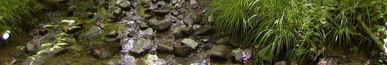
The Spring Creek watershed is one of 13 Cooperative State Research Education and Extension Service (CSREES) watershed studies initiated under the Conservation Effects Assessment Project (CEAP) in an effort to quantify the environmental effects of conservation practices by recognizing that environmental quality is the result of a complex interaction between these practices, the hydrology in the landscape, social and economic factors, and outreach efforts. The Spring Creek watershed is located in central Pennsylvania within the Ridge and Valley physiographic province. Land use patterns follow the topography of the region, with the ridges mostly forested and the limestone valleys primarily in agricultural and urban land uses. This watershed is under increasing pressure from urbanization. As a result, agricultural land use decreased from 1938 to 2006, while areas of developed land increased and forest land use remained relatively stable during this time period. Results from our study, which had five inter-related components, include the following:
Ground-based monitoring and ecological analyses found:
- Baseflow and stormflow water quality results showed total suspended solids (TSS) in both treatment streams were substantially less in latter phases of monitoring period than during the pre-treatment phase, while nutrient concentrations did not reveal any obvious trends.
- Fine sediment in stream substrates declined significantly in both treatment streams, but the response in Slab Cabin Run was delayed by drought. Macroinvertebrate densities increased in treatment streams following restoration, but fish community composition did not change in the treatment streams between pre- and post-treatment periods.
Important findings from the coarse- vs. fine-grained landscape characterization assessments were as follows:
- Current NRCS standards do not include recommendations to examine actual flow path from the heavy use area to the stream when determining related BMP placements.
- Visual assessments and straight-line paths from heavy use areas to streams often give misleading estimates of flow path lengths and stream entry points, resulting in inefficiently placed BMPs, and thus, use of GIS topographic data should be used to plot flow paths.
Important messages discerned from the landscape characterization and hydrologic/landscape modeling components of the project included:
- Fine-scale LiDAR-based topography data are essential to modeling stream processes affecting sediment transport at the watershed scale. Coarser-scaled elevation data does not provide enough information to identify incised channels, estimate channel dimensions, or identify riparian and floodplain areas.
- Hillslope processes affect stream sediment loads more by effects on channelized flow connections than by direct contributions of sediment delivery.
Take-home messages from the socio-economic analyses and outreach portion of the project were:
- Non-farmers are a bottleneck for riparian buffer adoption across the watershed.
- The amount a landowner hears about riparian buffers is also positively related to the amount heard about Chesapeake Bay water quality.
- Willingness to adopt riparian buffers increases with perceived knowledge about stream water quality.
- Riparian buffers are socially desirable based on the proportion of neighbors considered close friends. While this may encourage buffer adoption at the neighborhood scale, it may also discourage buffer adoption in areas where normative behaviors disapprove of riparian vegetation.
- Several outreach events that were held were reasonably effective in communicating findings.
This study illustrates the synergistic nature of watershed management, of which BMPs play an integral part. These results show the success of a BMP depends on a variety of factors including: (1) proper identification of the locations and sources of pollution, including the actual pathways by which it enters the stream; (2) proper alignment of the BMP with those locations; (3) effective monitoring techniques that target the stressor(s), match the BMP with the appropriate indicator, and allow sufficient time periods for capturing responses; and (4) capitalizing on proven factors that encourage landowner adoptions of BMPs, while effectively addressing impediments to BMP adoption. In addition, BMP success or failure is often dependent on external factors within the watershed, especially land use change and multiple-year weather patterns (e.g., drought, flooding). Thus, it is important to consider these additional impacts to water quality when attempting best management practices.